Training
Training camps
15.3. – 7.7.2024
Welcome to the JWOC 2024 training camps in the Pilsen region! We offer you to train in similar terrains as the JWOC 24 will take place. There will be many different training sessions available. Most of the trainings will be available from 15th March to 7th July.
Please, generally favor:
In light of recent events, we would like to remind you that you may enter the training space only during the time stated on this page. The time may differ depending on the given map/location. If you are not sure about whether you may or may not enter a given location for the purpose of a training session, go with the timeline from 8.00 to 16.00. We have problems with the owners of the forest areas when some teams do not respect this timeline.
Therefore, we would like you all to be considerate and obey the time stated on this page.
Please order your training maps 10 days before your arrival. You will receive maps printed in good quality on Pretex.
The last day to order training maps in good print quality is June 23 20:00 (UTC+2)! After this date, you can print the maps by yourself from pdf files we will sent you.
You will receive the ordered maps during your checkin in Lochotín student dormitory or by individual agreement.
List of trainings
last update: 28.5.2024 12:23 (UTC+2)
| No. | Availability | Map | Type of training | Length (km) |
| 21 | 15.3. – 7.7.2024 | Výtuň | Loops 5 x 1.0 – 1.5 km | 1.2, 1.0, 1.2, 1.1, 1.5 |
| 22 | 2.5. – 7.7.2024 Forbidden: 29 June | Barák | Long | W 9.6, M 11.6 |
| 23 | 22.4. – 7.7.2024 | Pytel | Special Corridor | W 5.5, M 6.5 |
| 24 | 15.3. – 7.7.2024 | Sušice | Sprint | C1 2.3, C2 2.2, C3 2.4 |
| 25 | 15.3. – 7.7.2024 | Bolevecká náves | Sprint relay | 2.17 – 2.95 |
| 26 | 15.3. – 7.7.2024 | Lomnička | Middle | W 3.6, M 5.0 |
| 27 | 20.3. – 7.7.2024 | Krkavec (NW slope) | Middle | W 3.5, M 4.5 |
| 28 | 15.3. – 7.7.2024 Forbidden: 22, 23 June (dogs have examing, there) | Býkovna | The first leg of relay | W 5.3, M 6.2 |
| 29 | 15.3. – 7.7.2024 | Peklo | Corridor | 3 – 8 |
| 30 | 17.6. – 30.6. 2024 | Klabava | Long distance | W 9.3, M 11.5 |
| 31 | 23.4. – 7.7.2024 | Lobzy | Forked sprint intervals | 4 x 0.8 |
| 32 | 14.5 – 7.7. 2024 | Oppidum Březina | Forest mass starts | approx. 6.5 sum |
| 33 | 15.3. – 7.7.2023 | Sytná | One-man relay | W 4.6, M 6.2 |
| 34 | 15.3. – 7.7.2023 | Krkavec (Ledce) | Middle | W 4.0, M 4.4 |
| 36 | 28.3. – 7.7.2023 | Výtuň | Corridor | 2 – 6 |
- Overview map in Google maps
- Please, avoid training at night. There is a danger of hunters shooting at this time!
- For trainings with forking control description will be printed directly on the map, only. Control descriptions for other trainings can be found in the training overview list at the end of this page or directly on each map, too.
- In case you are stopped by someone who does not speak English, we recommend having the confirmation at the end of this page printed.
- If the control mark is missing somewhere, please let us know.
- Please, do not drive any forest road!
- The best navigation apps: Google maps or MapyCZ.
- You can use IDOS to look for public connections. Virtuální karta is an app which can be used to look at and pay for public transportation in the Pilsen and Pilsen region, only.
- Livelox links will be distributed with your order spreadsheet.
Pricing
There are two options:
| Option | Price € (per athlete/training) | Price for printed but unused map € | Printing | Delivering maps |
| A | 6 | 1 | Laser Pretex® | To your accommodation or you will pick them up somewhere in Pilsen. Please send us the address of your accommodation with your order. |
| B | 5 | Your own (pdf files will be sent) |
All orders must be placed in advance via email at trainings@jwoc2024.cz at least 14 days before the pickup or your arrival. Google spreadsheet where you can fill details of your order will be sent by email. Payment information will be provided after your stay. In the order, please provide us the address of the payer of the invoice.
Control points
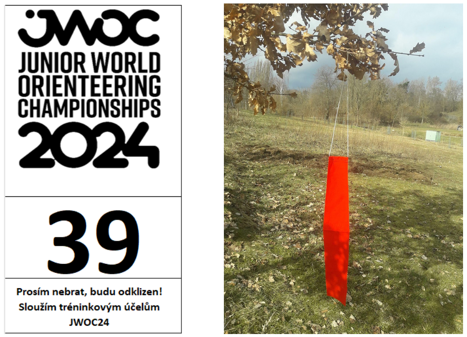
All control points in the forest are marked with a 0.5meter long red or orange ribbon. There is also an A6 board with the control number and JWOC 24 logo. The same ribbon is also at the start and finish of each training but without any paper board.
Control points will not be marked in the terrain in the sprint courses.
Other
Everyone participates in the training/competition at their own risk.
We kindly ask you all to behave in a respectful manner towards the environment. Sort the waste into the prepared containers. Do not leave any garbage in the forest or basically anywhere except places designated for it. Be careful when running nearroads.
In the forest is also forbidden:
– building tents and sleeping in the forest,
– making fire,
– being noisy,
– crossing fences which are in good condition,
– entering places where forest work is carried out.
Keep your distance when you hear a chainsaw, harvester or similar machines.
The training camps for JWOC2024 also take place in areas that belong to the state property of the Czech Republic. The property is managed by a state enterprise LČR s.p. Please be considerate and try to treat the environment as if it were your own.
Almost all relevant training terrains are in nature-protected areas. Therefore, all training activities shall be coordinated with the organizers.
Accommodation
The organisers do not provide accommodation.
We recommend you Hotel IBIS which is a partner of JWOC 2024. Please, If you take this way of accommodation, use a code ”JWOC” and add NameOfYourCountryOrClub in your communication with Hotel IBIS to get better conditions. Please use this contact to IBIS Hotel: +420377887777, or H6734@accor.com. The better conditions will not be provided if you use Booking or similar reservation systems.
For other options you can also check Airbnb or Booking. Make sure to contact us if you have any problems looking for accommodation, we are more than willing to help you.
Contact
In case of any questions feel free to contact us at trainings@jwoc2024.cz
Detailed description of each training
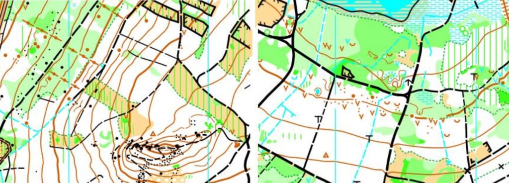
No. 21 Výtuň
Date: 15.3. – 7.7.2024
Time restriction: Please, do not do night orienteering! Orienteering is forbidden after 4 p.m.
Type of training: Loops 5 x 1.0 – 1.5 km
Parameters: 1.2, 1.0, 1.2, 1.1, 1.5km / 3 – 4 c
Map: 1 : 10 000 / E=5m / A5 / ISOM 2017-2 / updated 2024
Course setter: Radim Tokár
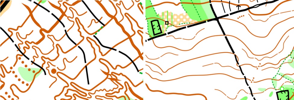
Terrain description: Pine, spruce, and broad-leave forest. The runnability is diverse because there are changing fast and slow parties because of vegetation. In the 18th and 19th centuries, there was mining coal and the impact is that many pits and knolls are there.
Start: 49.560299 N 13.152843 E
Finish: same as start
Public transport stop: “Merklín, Lhota” (bus)
Parking instructions:
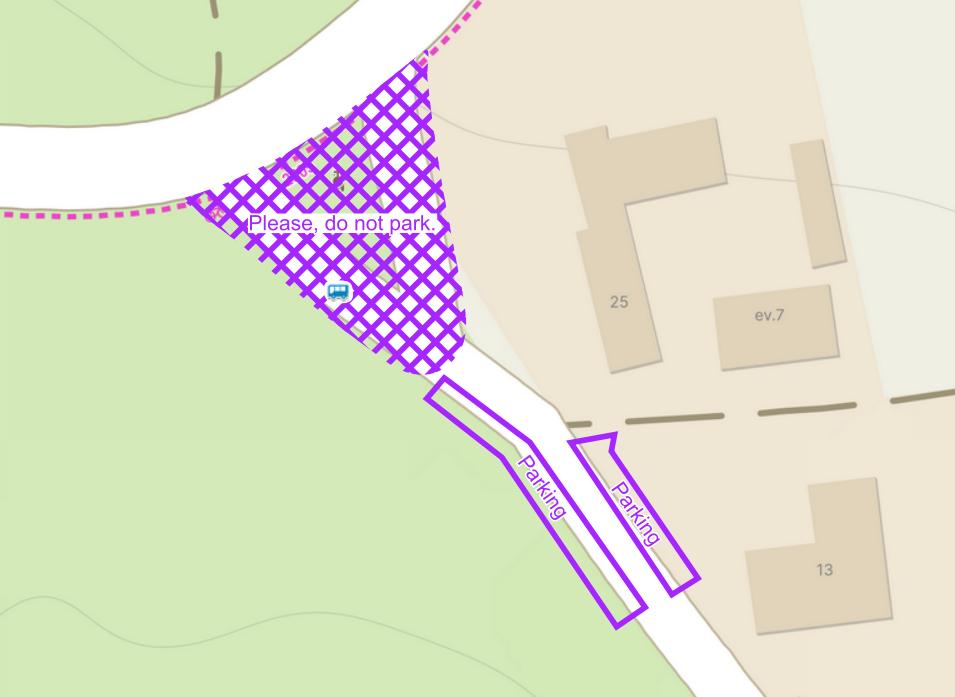
Parking (QR): 49.552936 N 13.153356 E

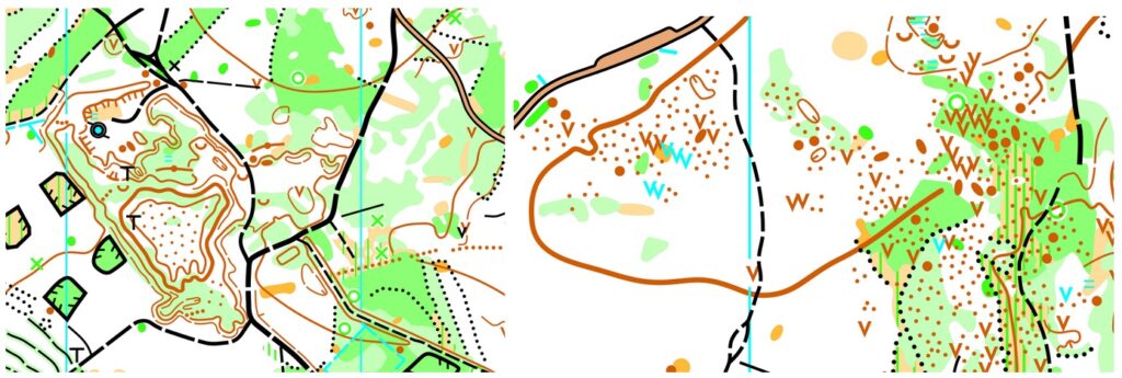
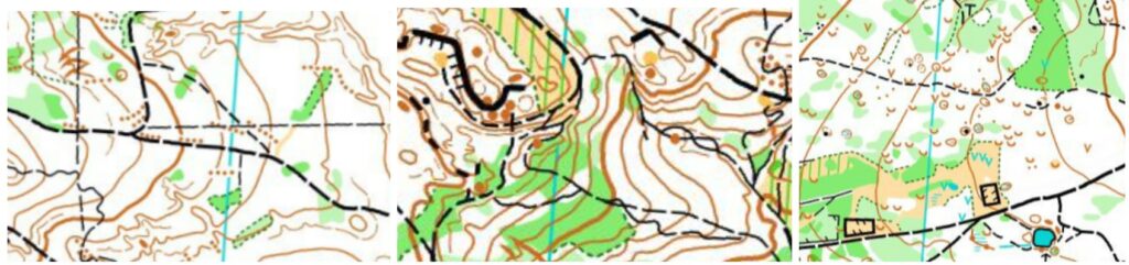
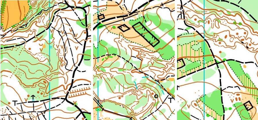
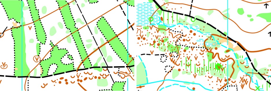
Map samples:
No. 22 Barák
Date: 2.5. – 7.7.2024
Forbidden: 29 June
Time restriction: Please, do not do night orienteering! Orienteering is forbidden after 5 p.m.
Type of training: Long
Parameters: W 9.6km / 290m / 21 c, M 11.6km / 290m / 25 c
Map: 1 : 15 000 / E=5m / A5 / ISOM 2017-2 / Mapped 2024 / Attention: map turn is used!
Course setter: Jakub Hulec
Terrain description: Moderate hilly, lots of green, undergrow, and stony ground. Mixture forest, with some knolls and stones, somewhrere rocks.
Start: 49.388928 N 13.395999 E
Finish: 49.386296 N 13.396606 E
Public transport stop: “Klatovy, Habartice, náves” (bus)
Parking (QR): 49.389680 N 13.405674 E (please do not block entries to the properties)

Map samples:
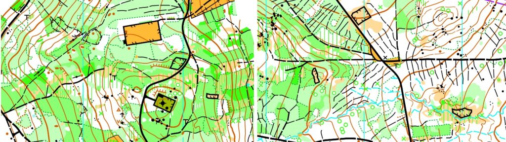
No. 23 Pytel
Date: 22.4. – 7.7.2024
Time restriction: Please, do not do night orienteering! Orienteering is forbidden after 5 p.m.
Type of training: Special Corridor
Parameters: W 5.5km / 100m / 30 c, M 6.5km / 100m / 34 c
Map: 1 : 10 000 / E=5m / A4 / ISOM 2017-2 / Mapped 2024
Course setter: Václav Bohuslav
Terrain description: One decent hill, pine and mixture forest, occasional bushes, lots of knolls, pits, stones and rocks.
Start: 49.736867 N 13.476810 E
Finish: same as start
Public transport stop: “Letkov, V Podlesí” (trolleybus no. 12)
Parking (QR): 49.736908 N 13.475430 E (please do not block entries to the properties)

Map samples:
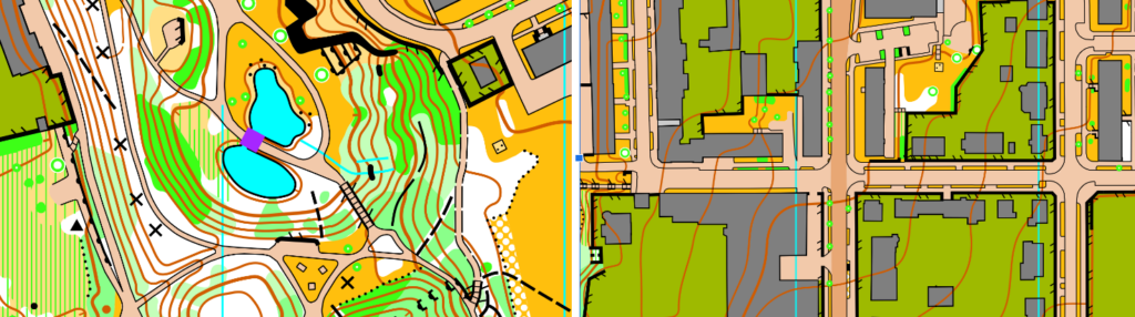
No. 24 Sušice
Date: 28.3. – 7.7.2024
Time restriction: Please, do not do night orienteering!
Type of training: Sprint
Parameters:
C1: 2.3km / 15m / 10 c
C2: 2.2km / 15m / 10 c
C3: 2.4km / 15m / 11 c
Map: 1 : 4 000 / E=2m / A4 / ISSprOM 2019-2 / mapped December 2023
Course setter: Ondřej Hasman (JWOC 2024 Sprint course setter)
Terrain description: Flat and small town under “Šumava” (Bohemian Forest) mountains. The old center of the city and one river called Otava. There are bridges over the Otava river and there is a typical development of small Czech cities on the second side of the river Otava.
Traffic: there are three main roads which should be crossed during the training where is heavier traffic. Please be very careful when crossing this roads.
Forbidden areas: Marked according to ISSprOM 2019-2. Symbol 709 (crossed hatches) is used for some artificial out-of-bounds area, they should not taped (they cross public streets).
Start: 49.227955 N 13.518867 E
Finish: 49.228132 N 13.519078 E
Public transport stop: “Sušice, nábřeží” (bus), “Sušice” (train)
Parking (QR): 49.224007 N 13.514596 E

Map samples:
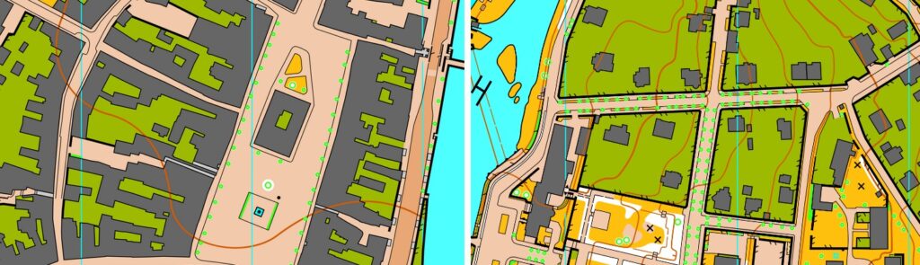
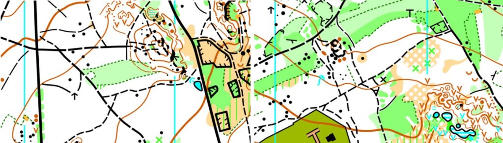
No. 25 Bolevecká náves
Date: 15.3. – 7.7.2024
Time restriction: Please, do not do night orienteering!
Type of training: Sprint relay
Parameters: (shortest running distance)
1st leg: 2.26 – 2.35km / 40 – 42m / 11 c
2nd leg: 2.80 – 2.90km / 58 – 60m / 13 c
3rd leg: 2.19 – 2.22km / 40 – 42m / 11-12 c
4th leg: 2.94 – 2.97km / 46 – 48m / 12-13 c
Map: 1 : 4 000 / E=2m / A4 / ISSprOM 2019-2 / updated 2024
Course setter: Radim Hošek (JWOC 2024 Sprint Relay course setter)
Terrain description: Residential area typical for 1980s – blocks of flats, large complexes of school buildings and areas; nearby forest with dense path network, historical center of the original Bolevec village.
Traffic: only minor roads with sparse traffic are crossed during the training. The density of traffic might increase during rush-hours. Be careful anyway.
Forbidden areas: Marked according to ISSprOM 2019-2. Symbol 709 (crossed hatches) is used for some artificial out-of-bounds area, they should not taped (they cross public streets).
System: Training is intended as a four-leg two-runners mixed relay – WMWM. 1st+2nd leg go into different direction than 3rd+4th. Farsta is used. 2nd and 4th legs are longer.
Start: 49.779941 N 13.376813 E
Finish, Arena – public playground at Bolevec: 49.779737 N 13.376776 E
Public transport stop: “Košutka” (tram 4), “Okounová” (tram 1, bus 30)
Parking (QR): 49.779326 N 13.381278 E or 49.780289 N 13.376225 E

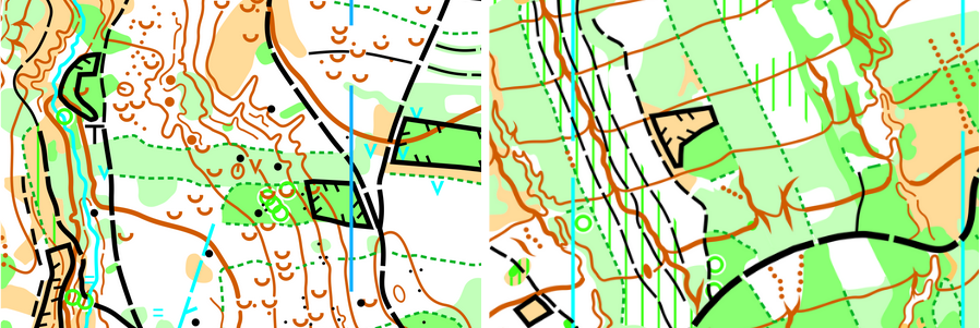
Map samples:
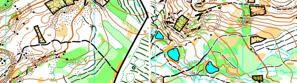
No. 26 Lomnička
Date: 15.3. – 7.7.2024
Time restriction: Please, do not do night orienteering! Orienteering is forbidden after 4 p.m.
Type of training: Middle
Parameters: W 3.6km / 135m / 15c, M 5.0km / 185m / 18c
Map: 1 : 10 000 / E=5m / A4 / ISOM 2017-2 / new map 2024
Course setter: Luboš Semík (JWOC 2024 Middle course setter)
Terrain description: Be sure, pine forests somewhere with thick blueberries. There are lots of knolls, erosion gullies, pits and one sand mine.
Attention: there is one low-frequented road through the terrain and courses, please be careful.
Start: 49.913973 N, 13.301000 E
Finish: 49.916415 N, 13.304935 E
Public transport stop: “Loza” (bus 4km away, but more connections), “Plasy, Lomnička” (bus)
Parking (QR): 49.916442 N 13.30841 E

Map samples:
No. 27 Krkavec
Date: 20.3. – 7.7.2024
Time restriction: Please, do not do night orienteering! Orienteering is forbidden after 5 p.m.
Type of training: Middle
Parameters: W 3.5km / 110m / 18 c, M 4.5km / 140m / 22 c
Map: 1 : 10 000 / E=5m / A4 / ISOM 2017-2 / updated 2024
Course setter: Václav Bohuslav
Terrain description: Pine forests, the southern part of the Krkavec hill is usually easily runnable, the runnability of the northern part is diverse because of undergrowth, lots of knolls, erosion gullies, and pits.
Start: 49.810154 N 13.343147 E
Finish: 49.808864 N 13.344979 E
Parking (QR): 49.812693 N 13.343456 E or 49.810382 N 13.345683 E

Map samples:
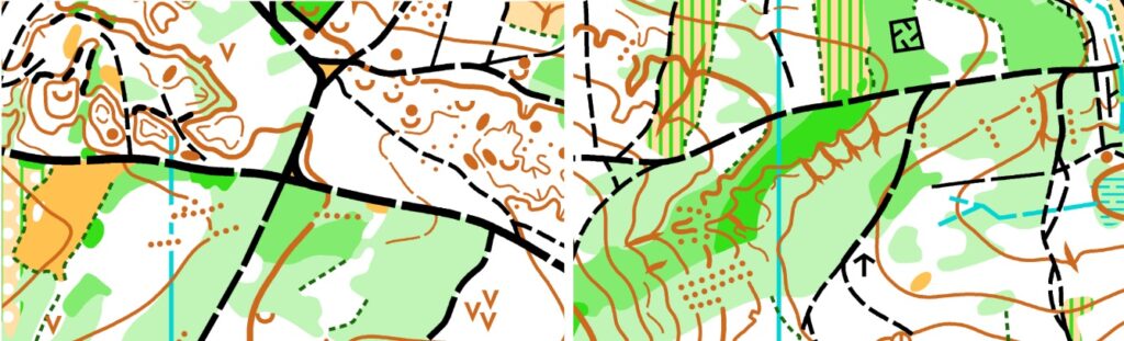
No. 28 Býkovna
Date: 15.3. – 7.7.2024
Forbidden: 22, 23 June (dogs have examing, there)
Time restriction: Please, do not do night orienteering! Orienteering is forbidden after 5 p.m.
Type of training: The first leg of relay (with forking)
Parameters: M 6.2 km, W 5.3 km
Map: 1 : 10 000 / E=5m / A3 / ISOM 2017-2 / updated 2024
Course setter: Lukáš Richtr (JWOC 2024 Relay course setter)
Terrain description: Good runnability, lots of small valleys, erosion gullies, typical terrain of the Pilsen-north region.
Start: 49.8394339N, 13.3944817E
Finish: 49.8408967 N, 13.3933986 E
Public transport stop: “Horní Bříza, rozc.1.0” (bus 1.7 km away)
Parking (QR): 49.8402933 N, 13.3923311 E

Map samples:
No. 29 Peklo
Date: 15.3. – 7.7.2024
Time restriction: Please, do not do night orienteering! Orienteering is forbidden after 5 p.m.
Type of training: Corridor
Parameters: 3-8 km, depend on your option
Map: 1 : 10 000 / E=5m / A4 / ISOM 2017-2 / updated 2024
Course setter: Ondřej Pova
Terrain description: Good runnability, lots of small valleys, erosion gullies, typical terrain of the Pilsen-north region, moderate hills.
Start: 49.938961 N 13.371618 E
Finish: 49.943374 N 13.371388 E
Public transport stop: “Plasy” (bus or train 1.8 km away)
Parking (QR): Car: 49.939665 N 13.373823 E / Bus: 49.937901 N 13.37098 E

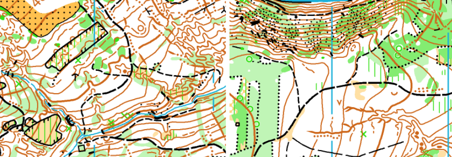
Map samples:
No. 30 Klabava
Date: 17.6. – 30.6. 2024
Time restriction: Please, do not do night orienteering! Orienteering is forbidden after 4 p.m.
Type of training: Long distance
Parameters: W 9.3km / 250m / 12 c, M 11.5km / 300m / 13 c
Map: 1 : 15 000 / E=5m / A4 / ISOM 2017-2 / updated 2024
Course setter: Tomáš Prokeš (JWOC 2024 Long distance course setter) and Lukáš & Aleš Richtr.
Terrain description: Pine and mixture forest, occasional bushes, stones and pits. One dump by mining of iron ore.
Start: 49.782240 N 13.517008 E
Finish: 49.779251 N 13.513535 E
Public transport stop: “Dýšina, Nová Huť” (bus)
Parking (QR): 49.783161 N 13.515940 E

Map samples:
No. 31 Lobzy
Date: 23.4. – 7.7.2024
Time restriction: Please, do not do night orienteering!
Type of training: Forked sprint intervals
Parameters: 4 x 0.8km (sum 62m elevation)
Map: 1 : 4 000 / E=2m / A5 / ISSprOM 2019-2 / Mapped 2024
Course setter: Václav Bohuslav
Terrain description: Residential area typical for the 1980s – blocks of flats, nearby park, and rough open land with undergrow and bushes.
Start: 49.742890 N 13.409950 E
Finish: 49.740738 N 13.409211 E
Public transport stop: “U Astry” (bus no. 29 or 30)
Parking (QR): 49.741753 N 13.409938 E

Map samples:
No. 32 Oppidum Březina
Date: 14.5. – 7.7.2024
Time restriction: Please, do not do night orienteering! Orienteering is forbidden after 5 p.m.
Type of training: Forest mass starts
Parameters:
A: 1.0 – 1.07km / 60m / 5 c
B : 1.78 – 1.81km / 35m / 5 c
C: 0.98 – 1.02km / 55m / 4 c
D: 1.45 – 1.49km / 50m / 11 c
E: 1.31 – 1.35km / 25m / 4 c
Map: 1 : 7 500 / E=5m / A5, A6 / ISOM 2017-2 / mapped 2024
Course setter: Kamila Richtrová
Terrain description: There was a Slavic oppidum. They built stone banks there. Somewhere is dense stony ground otherwise good runnability. There are some stones, rocks, and some overgrown places, too. This forest is composed of Norway spruce and beech, pine very less.
Start: 49.807419 N 13.606180 E
Finish: 49.811902 N 13.607081 E
Public transport stop: “Březina, zámek” (bus)
Parking (QR): 49.813250 N 13.603197 E

Map samples:
No. 33 Sytná (Krkavec)
Date: 15.3. – 7.7.2024
Time restriction: Please, do not do night orienteering! Orienteering is forbidden after 6 p.m.
Type of training: One-man relay
Parameters: W 4.6km / 3loops, M 6.2km / 4loops
Map: 1 : 10 000 / E=5m / A4 / ISOM 2017-2 / updated 2024
Course setter: Aleš Richtr
Terrain description: Pine forests, the southern part of the Krkavec hill is usually easily runnable, the runnability of the northern part is diverse because of undergrowth, lots of knolls, erosion gullies, and pits.
Start: 49.783770 N, 13.348728 E
Finish: same as start
Public transport stop: “Sídliště Košutka” (bus 30 or 33)
Parking (QR): 49.777095 N, 13.347576 E

Map samples:
No. 34 Ledce (Krkavec)
Date: 15.3. – 7.7.2024
Time restriction: Please, do not do night orienteering! Orienteering is forbidden after 5 p.m.
Type of training: Middle
Parameters: W 4.0km / 135m / 16c, M 4.4km / 160m / 17c
Map: 1 : 10 000 / E=5m / A4 / ISOM 2017-2 / updated 2024
Course setter: Arttu Syrjäläinen
Terrain description: Pine forest, occasional bushes, and pits, lots of tracks occasionally even single track. Very often erosion gullies and other earth details.
Start: 49.818258 N, 13.346957 E
Finish: 49.816967 N, 13.357190 E
Public transport stop: “Třemošná, Záluží, rozc.” (bus)
Parking (QR): 49.815370 N, 13.361141 E

Map samples:
No. 36 Výtuň
Date: 28.3. – 7.7.2024
Time restriction: Please, do not do night orienteering! Orienteering is forbidden after 3 p.m.
Type of training: Corridor
Parameters: 2-6km (shortcuts)
Map: 1 : 10 000 / E=5m / A5 / ISOM 2017-2 / updated 2024
Course setter: Radim Tokár
Terrain description: Pine, spruce, and broad-leave forest. The runnability is diverse because there are changing fast and slow parties because of vegetation. In the 18th and 19th centuries, there was mining coal and the impact is that many pits and knolls are there.
Start: same as parking
Finish: same as parking
Public transport stop: “Merklín, Lhota” (bus)
Parking instructions:
Parking (QR): 49.552936 N 13.153356 E
Map samples:
Link for download “Potvrzení”.
We shall thank our partners and all involved land owners as we are grateful for the permissions and support they have granted us. Cities and other institutes: Buková, Česká Bříza, Hromnice, Loza, Mochtín, Mrtník, Chotíkov, Ledce, Dýšina, Plzeň, Pláně, Plánice, Plasy, Poděvousy, Třemošná, Klatovy, Rokycany, Staňkov, Farnosti Dýšina and Plánice, Lesy Klatovy s.r.o..